Center for Louisiana Studies Archival Catalog
This searchable database provides information on images, documents, and audio and video recordings, made between 1934 and the present.
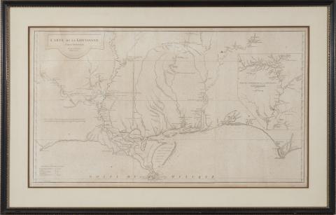
Contenants - Title and contents page leaf from "Atlas Ameriquain Septentional" 1778
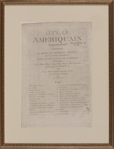
“Contenants,” (Paris: Chez Le Rouge, 1778), the title and contents page is here signed “Mitchell King, Paris 1840,” housed in a gilt wood frame, overall dimensions 29-1/2 x 22-1/4 in.
Description: Title and contents page leaf from "Atlas Ameriquain Septentional" published by Georges–Louis Le Rouge
This set of maps can likely be traced to antebellum Georgia attorney Mitchell King, whose papers are archived at The University of North Carolina, Chapel Hill.
The German-born George-Louis Le Rouge published these maps in Paris at a time when France renewed its active participation in American affairs. The maps meticulously show a rugged North American landscape between Canada and the Gulf of Mexico with details that would aid travelers – and armies - of that era. Accordingly, the Le Rouge maps became highly prized by strategists on both sides of the American Revolution. All plates in the Atlas are copperplate engravings of the period.
Contact us for information about accessing a higher resolution copy
Guillaume Penn Traite Avec Les Indiens
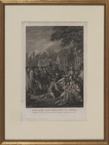
“Guillaume Penn Traite Avec Les Indiens” (Paris: Chez Le Rouge, 1778) after Benjamin West (1772), in gilt wood frame, overall dimensions 29-1/2 x 22-1/4 in.
Description: Title and contents page leaf from "Atlas Ameriquain Septentional" published by Georges–Louis Le Rouge
This set of maps can likely be traced to antebellum Georgia attorney Mitchell King, whose papers are archived at The University of North Carolina, Chapel Hill.
The German-born George-Louis Le Rouge published these maps in Paris at a time when France renewed its active participation in American affairs. The maps meticulously show a rugged North American landscape between Canada and the Gulf of Mexico with details that would aid travelers – and armies - of that era. Accordingly, the Le Rouge maps became highly prized by strategists on both sides of the American Revolution. All plates in the Atlas are copperplate engravings of the period.
Contact us for information about accessing a higher resolution copy
L’Amerique, 1774 map
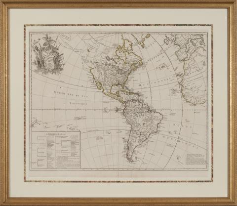
L’Amerique (Paris: Chez Crepy, 1774), after Charlevoix and La Condamine, in a gilt wood frame, 28-1/2 x 33 in. overall dimensions
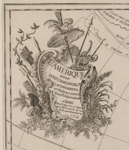
Detail of L’Amerique (Paris: Chez Crepy, 1774)
Description: North and South America map from "Atlas Ameriquain Septentional" published by Georges–Louis Le Rouge
This set of maps can likely be traced to antebellum Georgia attorney Mitchell King, whose papers are archived at The University of North Carolina, Chapel Hill.
The German-born George-Louis Le Rouge published these maps in Paris at a time when France renewed its active participation in American affairs. The maps meticulously show a rugged North American landscape between Canada and the Gulf of Mexico with details that would aid travelers – and armies - of that era. Accordingly, the Le Rouge maps became highly prized by strategists on both sides of the American Revolution. All plates in the Atlas are copperplate engravings of the period.
Contact us for information about accessing a higher resolution copy
Theatre de la Guerre en Amerique, 1777 map
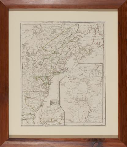
"Amerique Septentrionale" by John Mitchell (Paris: Chez Le Rouge, 1777), Third edition, fourth impression, with outline color and in four vertical sections, each being 54 x 18-3/4 in.
Description: Map from "Atlas Ameriquain Septentional" published by Georges–Louis Le Rouge
This set of maps can likely be traced to antebellum Georgia attorney Mitchell King, whose papers are archived at The University of North Carolina, Chapel Hill.
The German-born George-Louis Le Rouge published these maps in Paris at a time when France renewed its active participation in American affairs. The maps meticulously show a rugged North American landscape between Canada and the Gulf of Mexico with details that would aid travelers – and armies - of that era. Accordingly, the Le Rouge maps became highly prized by strategists on both sides of the American Revolution. All plates in the Atlas are copperplate engravings of the period.
Contact us for information about accessing a higher resolution copy
Carte des Troubles de L’Amerique, 1778 map
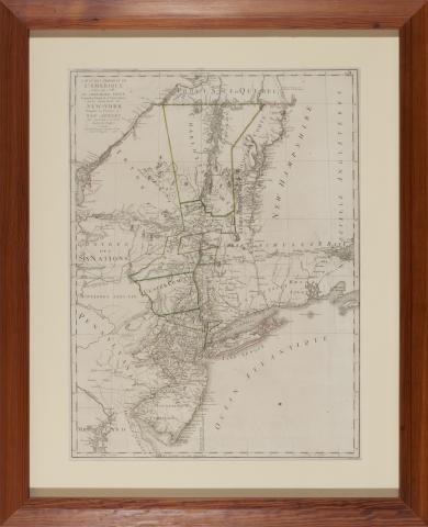
Carte des Troubles de L’Amerique…De la Province de New-York Ensemble la Province de New Jersey, Sauthier & Ratzer (Paris: Chez Le Rouge, 1778), outline color, presented in heart pine frame, overall dimensions 37-1/2 x 34-3/4 inches.
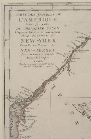
Detail of Carte des Troubles de L’Amerique…De la Province de New-York Ensemble la Province de New Jersey
Description: Map page leaf from "Atlas Ameriquain Septentional" published by Georges–Louis Le Rouge
This set of maps can likely be traced to antebellum Georgia attorney Mitchell King, whose papers are archived at The University of North Carolina, Chapel Hill.
The German-born George-Louis Le Rouge published these maps in Paris at a time when France renewed its active participation in American affairs. The maps meticulously show a rugged North American landscape between Canada and the Gulf of Mexico with details that would aid travelers – and armies - of that era. Accordingly, the Le Rouge maps became highly prized by strategists on both sides of the American Revolution. All plates in the Atlas are copperplate engravings of the period.
Contact us for information about accessing a higher resolution copy
Nouvelle Carte des Cotes des Carolines, 1777 map
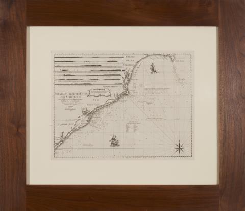
Nouvelle Carte des Cotes des Carolines by N. Pocock (Paris: Chez Le Rouge, 1777), presented in walnut frame, overall dimensions 32 x 37 inches
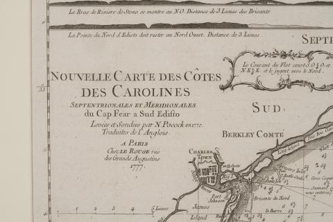
Detail of Nouvelle Carte des Cotes des Carolines
Description: Map page leaf of the Charleston, South Carolina coastal area from "Atlas Ameriquain Septentional" published by Georges–Louis Le Rouge
This set of maps can likely be traced to antebellum Georgia attorney Mitchell King, whose papers are archived at The University of North Carolina, Chapel Hill.
The German-born George-Louis Le Rouge published these maps in Paris at a time when France renewed its active participation in American affairs. The maps meticulously show a rugged North American landscape between Canada and the Gulf of Mexico with details that would aid travelers – and armies - of that era. Accordingly, the Le Rouge maps became highly prized by strategists on both sides of the American Revolution. All plates in the Atlas are copperplate engravings of the period.
Contact us for information about accessing a higher resolution copy
Carte de la Floride Occidentale et Louisiane, 1777 map
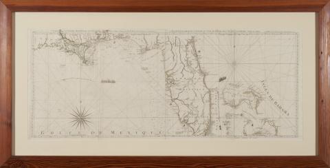
Carte de la Floride Occidentale et Louisiane with La Peninsule et Golfe de la Floride ou Canal de Bahama avec Les Isles de Bahama by Thomas Jefferys (Paris: Chez Le Rouge, 1777), two sheets, outline color, presented in heart pine frame, overall dimensions 29 x 58 inches.
Description: Map page leaf from "Atlas Ameriquain Septentional" published by Georges–Louis Le Rouge that features Southern Louisiana, Florida, and the Bahamas
This set of maps can likely be traced to antebellum Georgia attorney Mitchell King, whose papers are archived at The University of North Carolina, Chapel Hill.
The German-born George-Louis Le Rouge published these maps in Paris at a time when France renewed its active participation in American affairs. The maps meticulously show a rugged North American landscape between Canada and the Gulf of Mexico with details that would aid travelers – and armies - of that era. Accordingly, the Le Rouge maps became highly prized by strategists on both sides of the American Revolution. All plates in the Atlas are copperplate engravings of the period.
Contact us for information about accessing a higher resolution copy
A New Map of Nova Scotia and Cape Breton Island, 1775
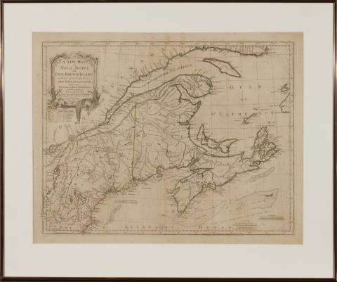
A New Map of Nova Scotia and Cape Breton Island, by Thomas Jefferys (London: R. Sayer & J. Bennett, 1775), presented in copper-toned frame. 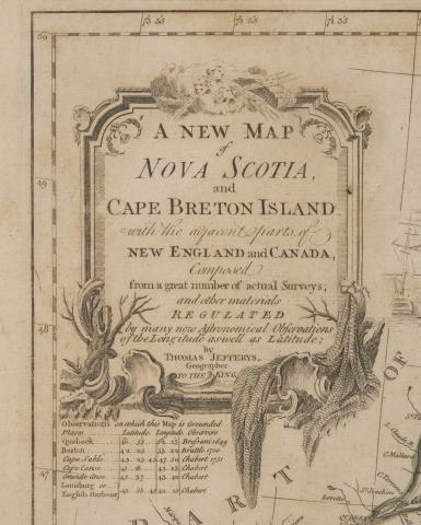
Detail of A New Map of Nova Scotia and Cape Breton Island
Course of the River Mississippi, From Balise to Fort Chartres, 1775 map
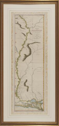
Thomas Jefferys, Course of the River Mississippi, From Balise to Fort Chartres; Taken on an Expedition to the Illinois, in the latter end of the year 1765 by Lieut. Ross of the 34th Regiment: Improved on the Surveys of that River made by the French. (London: Robert Sayer, 1775), hand color, presented in gilt wooden frame, overall dimensions 57 x 27 inches.
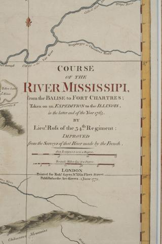
Detail of Course of the River Mississippi, From Balise to Fort Chartres; Taken on an Expedition to the Illinois, in the latter end of the year 1765 by Lieut. Ross of the 34th Regiment: Improved on the Surveys of that River made by the French
Fort Beau Sejour, and the Adjacent Country taken Possession of by Colonel Monckton in June 1755 map
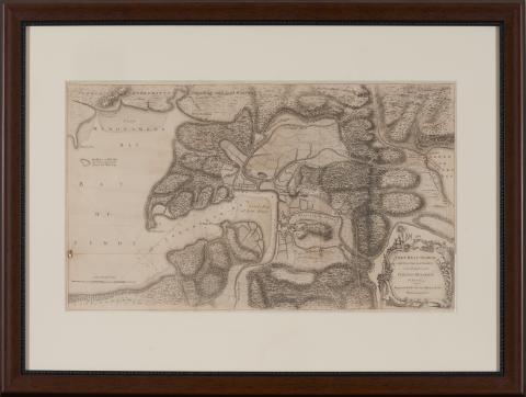
Fort Beau Sejour, and the Adjacent Country taken Possession of by Colonel Monckton in June 1755, Engraved for Mr. Mantes History of the War in America (London: Strahan & Cadell, 1772), presented in wooden frame, overall dimensions 23 x 31 inches
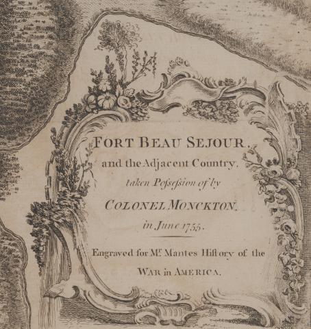
Detail of Fort Beau Sejour, and the Adjacent Country taken Possession of by Colonel Monckton in June 1755
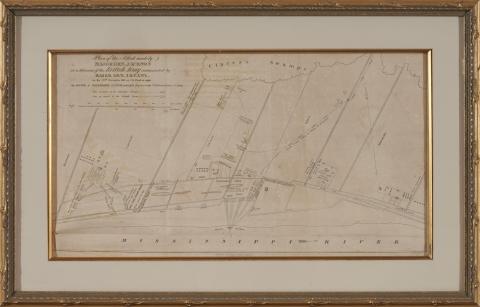
Plan of the Attack and Defence of the American Lines below New Orleans on the 8th of January map
Plan of the Attack and Defence of the American Lines below New Orleans on the 8th of January, 1815. from Latour, Arsene Lacarriere. Historical Memoir of the War in West Florida and Louisiana in 1814 – 1815 (Philadelphia: John Conrad & Co., 1816), in gilt wooden frame, overall dimensions 12 x 16 inches.
Detail of Plan of the Attack and Defence of the American Lines below New Orleans on the 8th of January.
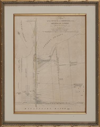
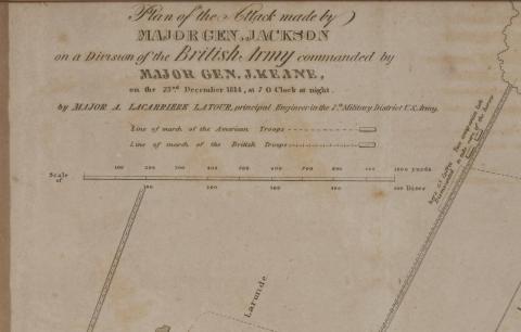
Plan of the Attack Made by Major Gen. Jackson on a Division of the British Army commanded by Major Gen. J. Keane on the 23rd December 1814, at 7 O Clock at night map
Plan of the Attack Made by Major Gen. Jackson on a Division of the British Army commanded by Major Gen. J. Keane on the 23rd December 1814, at 7 O Clock at night. from Latour, Arsene Lacarriere. Historical Memoir of the War in West Florida and Louisiana in 1814 – 1815 (Philadelphia: John Conrad & Co., 1816), in gilt wooden frame, overall dimensions 14 x 21-1/2 inches.
Detail of Plan of the Attack Made by Major Gen. Jackson on a Division of the British Army commanded by Major Gen. J. Keane on the 23rd December 1814, at 7 O Clock at night.
Carte de la Louisiane Par Le St. D’Anville Dressé en Mai 1732- 1752 map
Carte de la Louisiane Par Le St. D’Anville Dressé en Mai 1732. Publiée en 1752. (Paris, 1752), showing the Gulf coast from Louisiana eastward to the Florida panhandle, presented in wooden frame, overall dimensions 29 x 45 inches.
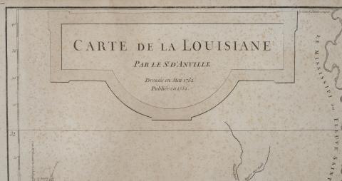
Detail of Carte de la Louisiane Par Le St. D’Anville Dressé en Mai 1732. Publiée en 1752.
Louisiana map 1813/1814
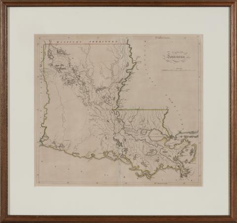
Louisiana (Philadelphia, Matthew Carey & Son, 1813/4), outline color, presented in wooden frame, overall dimensions 21 x 24 inches.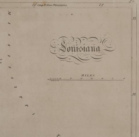
Detail from Louisiana 1813 / 1814
Geographical, Statistical, and Historical Map of Louisiana, 1822 map
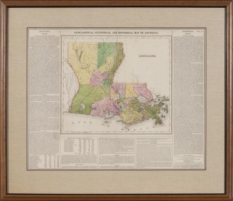
Geographical, Statistical, and Historical Map of Louisiana (Philadelphia: Carey & Lea, 1822), presented in a wooden frame, overall dimensions 23-1/2 x 25 inches.
Plan of New Orleans the Capital of Louisiana, 1761 map
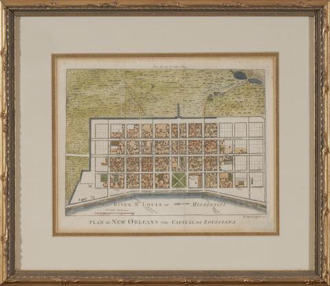
Plan of New Orleans the Capital of Louisiana, engraved by Robert Benning for the April 1761 issue of London Magazine, hand color, gilt wooden frame, overall dimensions 13 x 14-1/2 inches.
Map of the States of Mississippi, Louisiana and the Arkansas Territory, 1832
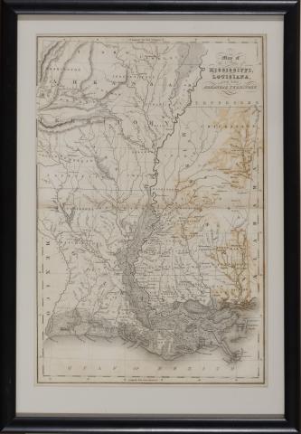
Map of the States of Mississippi, Louisiana and the Arkansas Territory (1832), by John Hinton presented in black wooden frame, overall dimensions 10-1/4 x 14 inches.
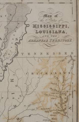
Detail of Map of the States of Mississippi, Louisiana and the Arkansas Territory
Southern Provinces of the United States, 1817 map
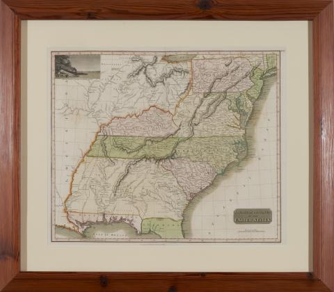
Southern Provinces of the United States (Edinburgh: John Thompson & Co., 1817) by John Thompson, with color, heart pine frame, overall dimensions 30 x 34 inches.
County Map of the States of Arkansas, Mississippi and Louisiana, map 1870
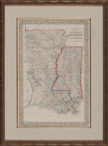
County Map of the States of Arkansas, Mississippi and Louisiana (Philadelphia: S. Augustus Mitchell, Jr., 1870), steel engraving with color, framed, overall dimensions 28-3/4 x 21-1/2 inches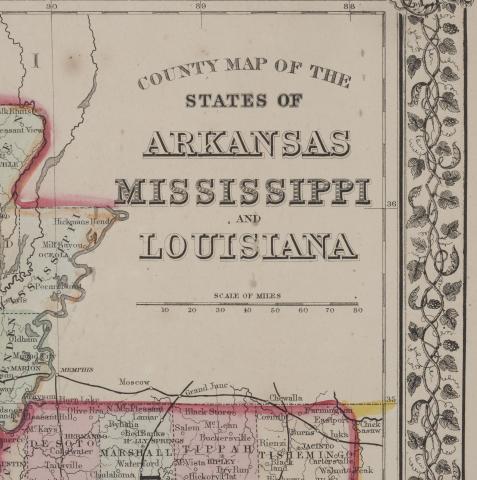
Detail of County Map of the States of Arkansas, Mississippi and Louisiana.
Carte Réduite D'une Partie de l'Ocean Atlantique ou Occidental, 1775 map
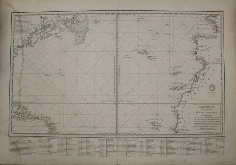
"Carte Réduite D'une Partie de l'Ocean Atlantique ou Occidental", 1775 map
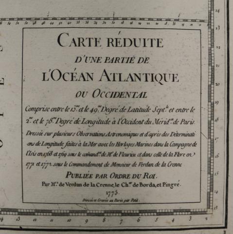
"Carte Réduite D'une Partie de l'Ocean Atlantique ou Occidental" detail, 1775 map
Louisiana map, 1858
Louisiana map, 1858
Louisiana map detail, 1858
Louisiana map from Harper's Weekly, February 3. 1866
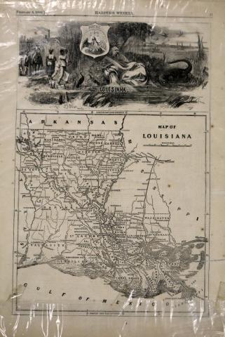
Louisiana map from Harper's Weekly, February 3, 1866

Detail from Louisiana map from Harper's Weekly, February 3, 1866
Acadian Memorial interpretive brochure
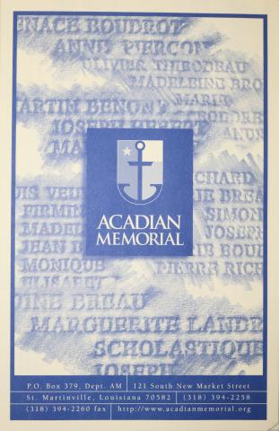
Information from the Acadian Memorial, Saint Martinville, St. Martin Parish, Louisiana
Arrival of the Acadians in Louisiana by Robert Dafford

The Arrival of the Acadians in Louisiana, by Robert Dafford, print
Commissioned by the City of St.. Martinville, Louisisna and installed in the Acadian Memorial on October 28, 1995
Acadian Heritage Week brochure 2005
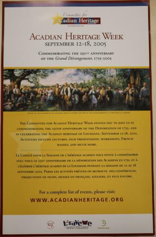
Acadian Heritage Week brochure 2005
Brouchure commemorating the 250th Anniversary of the Grand Derangement, 1755-2005
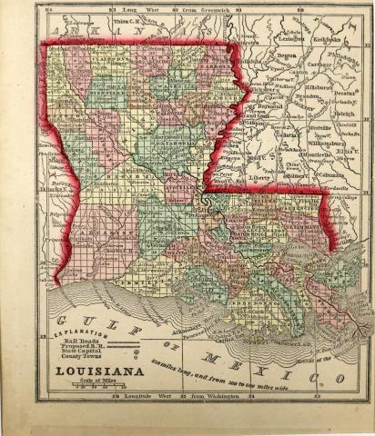
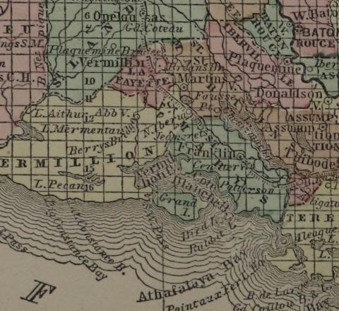
Louisiana map, 1855
Louisiana map, J.H. Colton & Co., New York, 1855
Louisiana map detail,1855
An Exact Replica of Nova Scotia, Newfoundland, Gulf and River St. Laurence, and Coast of Labradore, 1777 map
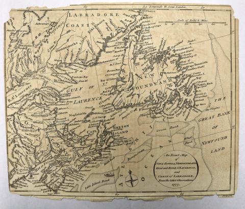
An Exact Replica of Nova Scotia, Newfoundland, Gulf and River St. Laurence, and Coast of Labradore, 1777 map
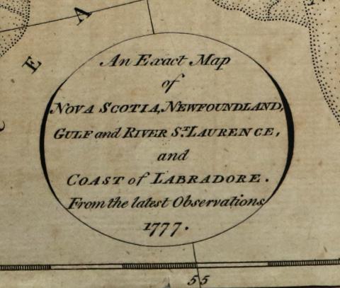
An Exact Replica of Nova Scotia, Newfoundland, Gulf and River St. Laurence, and Coast of Labradore, 1777 map detail
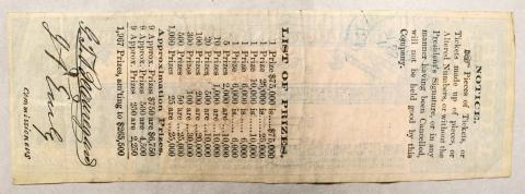
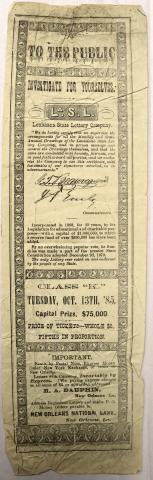
Official Drawing of the Louisiana State Lottery results, September 8, 1885
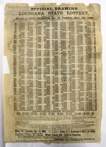
Official Drawing of the Louisiana State Lottery results, September 8, 1885
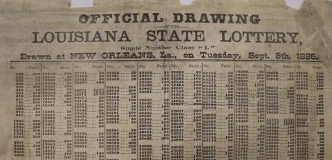
Official Drawing of the Louisiana State Lottery results, September 8, 1885 detail
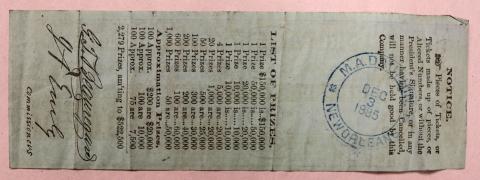
Louisiana State Lottery ticket from September 8, 1885
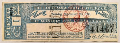
Louisiana State Lottery ticket from September 8, 1885 (front)
Louisiana State Lottery ticket from September 8, 1885 (back)
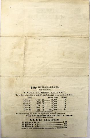
Louisiana State Lottery ticket from December 15, 1885
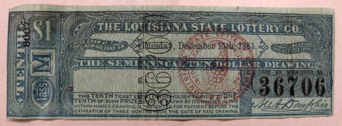
Louisiana State Lottery ticket from December 15, 1885 (front)
Louisiana State Lottery ticket from December 15, 1885 (back)
Louisiana State Lottery ticket order form, M.A. Dauphin Company, New Orleans, 1885
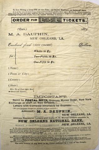
State Lottery ticket order form, M.A. Dauphin Company, New Orleans, 1885 (front)
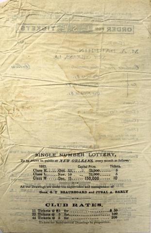
tate Lottery ticket order form, M.A. Dauphin Company, New Orleans, 1885 (back)
State Lottery ticket order form, M.A. Dauphin Company, New Orleans, August 21, 1885
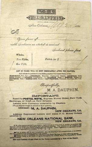
State Lottery ticket order form, M.A. Dauphin Company, New Orleans, August 21, 1885 (front)
State Lottery ticket order form, M.A. Dauphin Company, New Orleans, August 21, 1885 (back)
Louisiana State Lottery advertisement, M.A. Dauphin Company, New Orleans, October 1885
Louisiana State Lottery advertisement, M.A. Dauphin Company, New Orleans National Bank, New Orleans, October 1885
State of Louisiana bond sheet, 1879
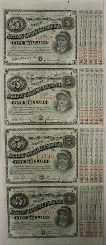
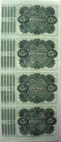
State of Louisiana $5 Bond sheet, 1879, front and back
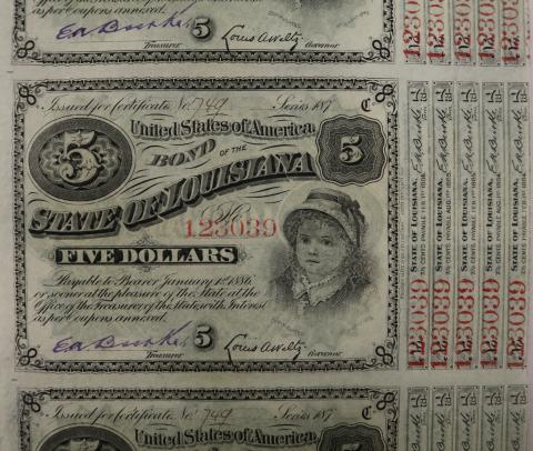
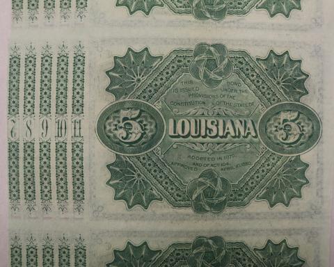
State of Louisiana $5 Bond sheet, 1879, front and back detail
General Mouton statue, Lafayette, Louisiana postcard
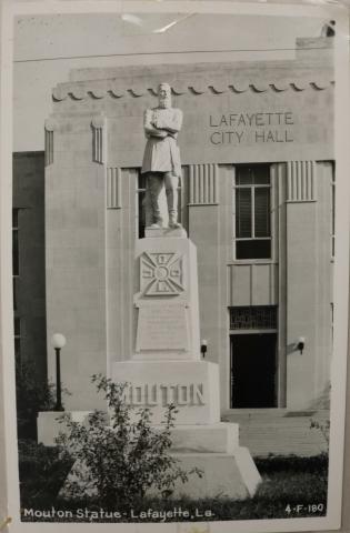
General Mouton statue, Lafayette, Louisiana postcard
"Who are the Creoles?" page by George Washington Cable
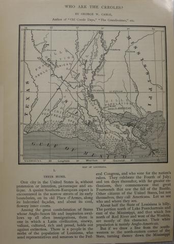
"Who are the Creoles?" page by George Washington Cable with Louisiana map
Confederate General Paul Herbert photograph
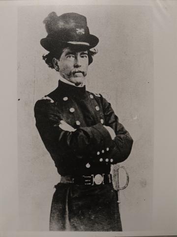
Confederate General Paul Herbert photograph
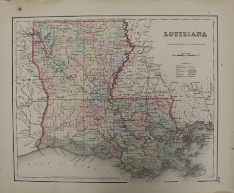
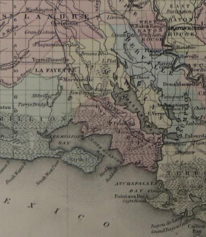
Map of Louisiana, 1855
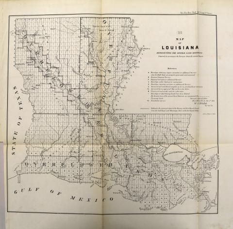
Louisiana map, drawn by Surveyor General's Office, Donaldsonville, Louisiana, William J. McCulloh, October 1, 1855
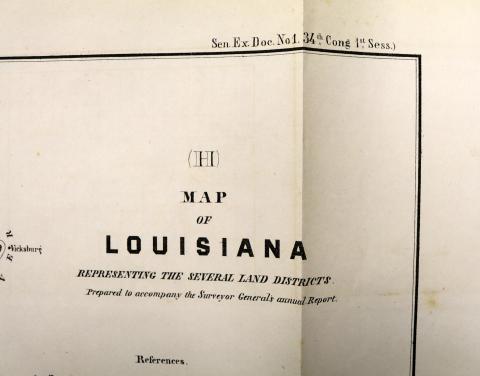
Louisiana map detail, 1855
George Rodrigue Retrospect Exhibition advertisement, 1974
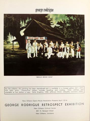
George Rodrigue Retrospect Exhibition advertisement, 1974
George Rodrigue advertisement, "The Class", Art in America page

George Rodrigue advertisement, "The Class" painting, Art in America page