Baye de la Delaware map, 1777
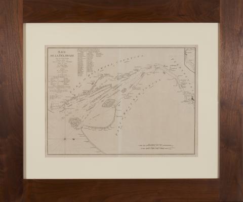
Baye de la Delaware by Joshua Fisher (Paris: Chez Le Rouge, 1777), presented in walnut frame, overall dimensions 34-1/2 x 41-1/2 inches.
This set of maps from the Atlas Ameriquain Septentional was purchased by the present owner from William Nash Rare Books in Atlanta, Georgia in the 1980s. It was previously acquired from the King family of the Atlanta-based King & Spalding law firm and can likely be traced to antebellum Georgiaattorney Mitchell King, whose papers are archived at The University of North Carolina, Chapel Hill.
The German-born George-Louis Le Rouge published these maps in Paris at a time when France renewed its active participation in American affairs. The maps meticulously show a rugged North American landscape between Canada and the Gulf of Mexico with details that would aid travelers – and armies - of that era. Accordingly, the Le Rouge maps became highly prized by strategists on both sides
of the American Revolution.
All plates in the Atlas are copperplate engravings of the period.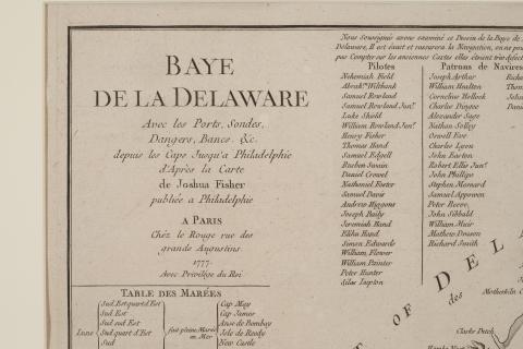
Details of Baye de la Delaware map, 1777.