Caroline Meridionale et Partie de la Georgie map, 1777
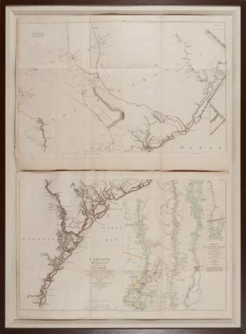
Caroline Meridionale et Partie de la Georgie by William Gerard de Brahm (Paris: Chez Le Rouge 1777), on four sheets, the lower half with an inset map by Sauthier showing the course of the Hudson River, hand color, presented in wooden frame, overall dimensions 48-1/4 x 56 inches.
This set of maps can likely be traced to antebellum Georgia attorney Mitchell King, whose papers are archived at The University of North Carolina, Chapel Hill.
The German-born George-Louis Le Rouge published these maps in Paris at a time when France renewed its active participation in American affairs. The maps meticulously show a rugged North American landscape between Canada and the Gulf of Mexico with details that would aid travelers – and armies - of that era. Accordingly, the Le Rouge maps became highly prized by strategists on both sides of the American Revolution. All plates in the Atlas are copperplate engravings of the period.
Contact us for information about accessing a higher resolution copy
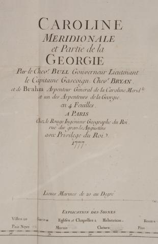
Detail of Caroline Meridionale et Partie de la Georgie map, 1777.
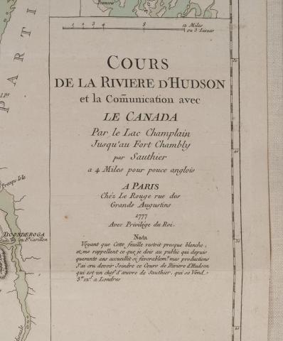
Detail of Caroline Meridionale et Partie de la Georgie map, 1777.