A Map of Pennsylvania or La Pensilvanie, 1778
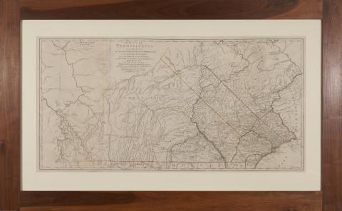
A Map of Pennsylvania or La Pensilvanie by William Scull (Paris: Chez Le Rouge, 1778), outline color, presented in walnut frame, in three parts, overall dimensions 43 x 68 inches.
Originally included in Atlas Ameriquain Septentional published by Georges–Louis Le Rouge. The German-born George-Louis Le Rouge published these maps in Paris at a time when France renewed its active participation in American affairs. The maps meticulously show a rugged North American landscape between Canada and the Gulf of Mexico with details that would aid travelers – and armies - of that era. Accordingly, the Le Rouge maps became highly prized by strategists on both sides of the American Revolution. All plates in the Atlas are copperplate engravings of the period.
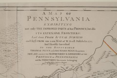
Detail of A Map of Pennsylvania or La Pensilvanie by William Scull, 1778