Map of the States of Mississippi, Louisiana and the Arkansas Territory, 1832
Accession No.:
I-MA2-017
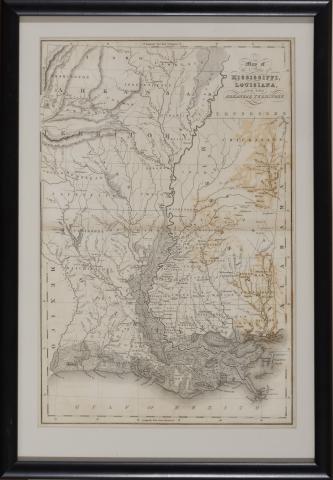
Map of the States of Mississippi, Louisiana and the Arkansas Territory (1832), by John Hinton presented in black wooden frame, overall dimensions 10-1/4 x 14 inches.
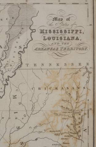
Detail of Map of the States of Mississippi, Louisiana and the Arkansas Territory
Media Type:
Image
Collection:
Robert J. Martin, Jr.
Subject:
Mississippi, Louisiana and the Arkansas
Recording date:
Wednesday, September 14, 2022
Coverage Spatial:
Mississippi, Louisiana and the Arkansas
Language:
English