Course of the River Mississippi, From Balise to Fort Chartres, 1775 map
Accession No.:
I-MA2-009
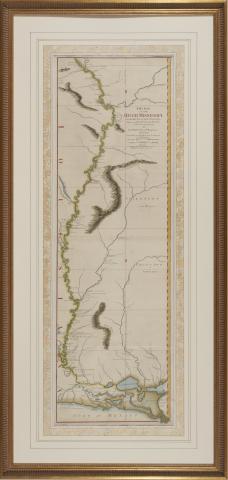
Thomas Jefferys, Course of the River Mississippi, From Balise to Fort Chartres; Taken on an Expedition to the Illinois, in the latter end of the year 1765 by Lieut. Ross of the 34th Regiment: Improved on the Surveys of that River made by the French. (London: Robert Sayer, 1775), hand color, presented in gilt wooden frame, overall dimensions 57 x 27 inches.
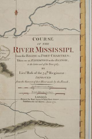
Detail of Course of the River Mississippi, From Balise to Fort Chartres; Taken on an Expedition to the Illinois, in the latter end of the year 1765 by Lieut. Ross of the 34th Regiment: Improved on the Surveys of that River made by the French
Media Type:
Image
Collection:
Robert J. Martin, Jr.
Subject:
Mississippi River map 1775
Recording date:
Wednesday, September 14, 2022
Coverage Spatial:
Missouri, Arkansas, Louisiana
Language:
English