Nouvelle Carte des Cotes des Carolines, 1777 map
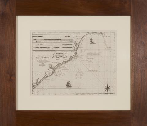
Nouvelle Carte des Cotes des Carolines by N. Pocock (Paris: Chez Le Rouge, 1777), presented in walnut frame, overall dimensions 32 x 37 inches
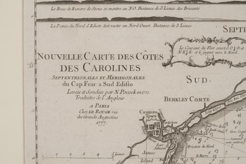
Detail of Nouvelle Carte des Cotes des Carolines
Description: Map page leaf of the Charleston, South Carolina coastal area from "Atlas Ameriquain Septentional" published by Georges–Louis Le Rouge
This set of maps can likely be traced to antebellum Georgia attorney Mitchell King, whose papers are archived at The University of North Carolina, Chapel Hill.
The German-born George-Louis Le Rouge published these maps in Paris at a time when France renewed its active participation in American affairs. The maps meticulously show a rugged North American landscape between Canada and the Gulf of Mexico with details that would aid travelers – and armies - of that era. Accordingly, the Le Rouge maps became highly prized by strategists on both sides of the American Revolution. All plates in the Atlas are copperplate engravings of the period.
Contact us for information about accessing a higher resolution copy