Map of the States of Mississippi, Louisiana and the Arkansas Territory, 1832
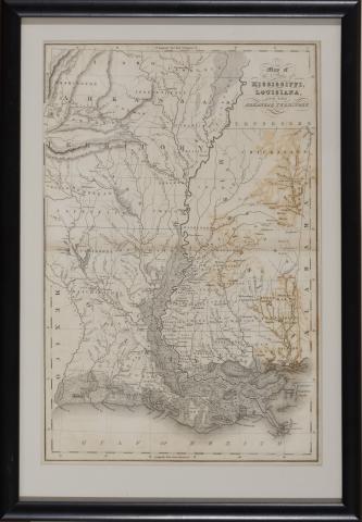
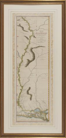
Map of the States of Mississippi, Louisiana and the Arkansas Territory (1832), by John Hinton presented in black wooden frame, overall dimensions 10-1/4 x 14 inches.
Map of the States of Mississippi, Louisiana and the Arkansas Territory (1832), by John Hinton presented in black wooden frame, overall dimensions 10-1/4 x 14 inches.
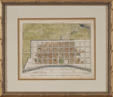
Plan of New Orleans the Capital of Louisiana, engraved by Robert Benning for the April 1761 issue of London Magazine, hand color, gilt wooden frame, overall dimensions 13 x 14-1/2 inches.
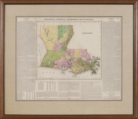
Geographical, Statistical, and Historical Map of Louisiana (Philadelphia: Carey & Lea, 1822), presented in a wooden frame, overall dimensions 23-1/2 x 25 inches.
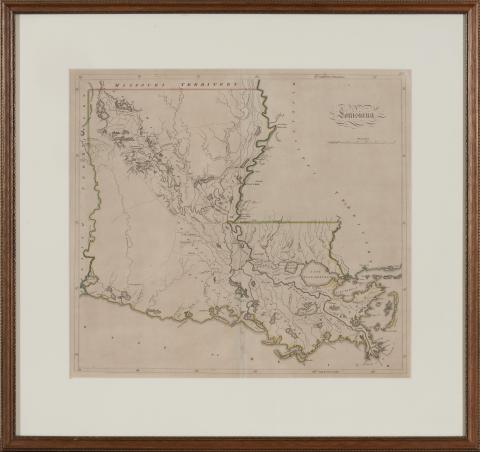
Louisiana (Philadelphia, Matthew Carey & Son, 1813/4), outline color, presented in wooden frame, overall dimensions 21 x 24 inches.
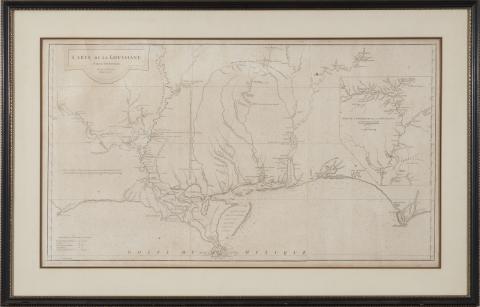
Carte de la Louisiane Par Le St. D’Anville Dressé en Mai 1732. Publiée en 1752. (Paris, 1752), showing the Gulf coast from Louisiana eastward to the Florida panhandle, presented in wooden frame, overall dimensions 29 x 45 inches.
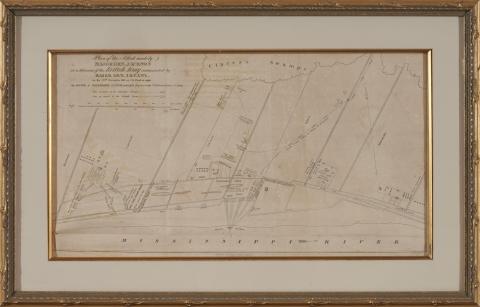
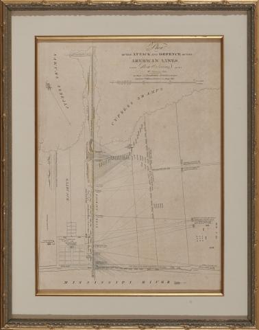
Plan of the Attack and Defence of the American Lines below New Orleans on the 8th of January, 1815. from Latour, Arsene Lacarriere. Historical Memoir of the War in West Florida and Louisiana in 1814 – 1815 (Philadelphia: John Conrad & Co., 1816), in gilt wooden frame, overall dimensions 12 x 16 inches.
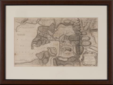
Fort Beau Sejour, and the Adjacent Country taken Possession of by Colonel Monckton in June 1755, Engraved for Mr. Mantes History of the War in America (London: Strahan & Cadell, 1772), presented in wooden frame, overall dimensions 23 x 31 inches
Collection Currently Inaccessible - Contact CLS
Demo Recording
Cassette says, "Zack, Eric's Song."